|
Historical coastlines (community perspectives) - Assessing
intergenerational attitudes to environmental change
Historical Coastlines (community perspectives), was a joint
CQU/Coastal CRC research task applying historical methodology
to investigate the relationships between local communities
and their coastal and estuarine environments. Focussing on
the Fitzroy River and the Capricorn Coast its aim was to help
foster awareness of the past states of local environments,
develop a better understanding of intergenerational attitudes
to environmental change, and consequently to encourage an
appreciation that environmental management is an intergenerational
concern.
Current projects:
Sculpting the Capricorn Coast: bridges, barriers
and beach erosion
(Cosgrove & Mullins)
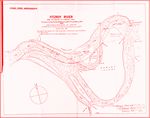
 Fitzroy River improvements 1876 (click on image to get
a larger view - 61KB)
 |
This project aimed to stimulate public curiosity about the
physical changes that have occurred
on the Capricorn Coast over the past 100 years or so,
to encourage residents to take an active interest in the impact
of development on the local natural environment. It takes
as a unifying theme the construction of the Scenic Highway
in the late 1930s, which was built to connect the coastal
towns of Yeppoon and Emu Park. The analysis included investigations
into the re-development of Yeppoon main beach esplanade in
the 1930s and 40s, the construction of the first Ross Creek
bridge in 1925-26, the road spur to Double Head (now Rosslyn
Bay boat harbour) and the Causeway Bridge (1939). The examination
of each infrastructure decision revealed useful insights into
historical motivations for development and re-development
on the Capricorn Coast, and community responses to those developments.
Taming a ‘disorderly, hydra-headed, tidal river’.
(Webster & Mullins)
 Flood on the Fitzroy 1918 (click on image to get a larger
view - 54KB)
 |
This project explored the historical relationship between
the people of Rockhampton and the Fitzroy River. It involved
detailed research into the
‘training’ of the estuary from the 1870s to about the
1930s, which was undertaken to scour the river bed and make
it navigable for shipping from the sea sixty kilometres to
the town. It also has resulted in the publication of a monograph
(pp.134), Marooned: Rockhampton's Great Flood of 1918, which
describes how the people of Rockhampton dealt with the greatest
calamity that nature ever inflicted upon them. Another outcome
of this project was a ‘Timeline
of Change on the Fitzroy 1855-1955’.
Image & Manuscript Archive
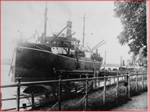
 Quay Street Wharfs (click on image to get a larger view
- 38KB)
 |
The project also developed an historical
image and manuscript archive illustrative and informative
of physical environmental change in the Fitzroy River estuary
and on the Capricorn Coast. The archive was compiled as a
first port of call for individuals and community groups who,
for instance, might be interested in researching historical
change in specific locations, or baseline biophysical data,
or to demonstrate land use patterns, illustrate cultural continuities,
or simply to satisfy their curiosity about the past states
and uses of these local environments. If you click through
to the archive via the link above you will also find a case
study of these images and manuscripts might be used. It is
called 'Shifting sands'.
The archival material was collected throughout the life of
the project, initially from institutional repositories, in
particular the Capricornia Collection of the CQU Library,
the Rockhampton and District Historical Society collection,
the Emu Park Historical Museum collection, and the Capricorn
Coast Historical Society collection. We are indebted to the
management and staff of CQU Library, the executives of the
local historical societies and museum for their friendly cooperation.
So far the image archive contains about 700 photographs. As
part of the project local historians have undertaken the laborious
and time-consuming process of accurately identifying and dating
the images.
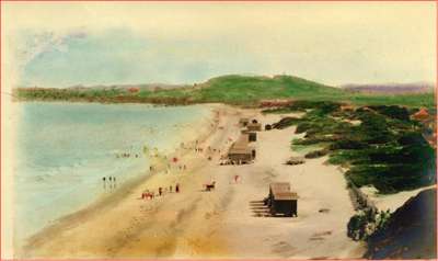
 Yeppoon Main Beach circa 1920
 |
Darumbal memories of the Fitzroy
(Hatfield & Mullins)
A collaboration with Doug Hatfield, executive member of the Darumbal-Noolar
Murree Aboriginal Corporation for Land and Culture, native
title claimants for the northern side of the Fitzroy River
estuary, to collect traditional stories and more contemporary
memories of Darumbal life on the River and adjacent waterways,
and incorporate them with ethnographic evidence to produce
a brief but overarching narrative of the Darumbal relationship
with the coastal zone.
Australian South Sea Islanders (ASSI) at Joskeleigh,
Keppel Sands & Moores Creek: identity and place
(Lander & Mullins)
The aim of this project wais to describe and theorise the
ASSI relationship to place in the coastal and estuarine zone
of the Fitzroy region, and taking that into account make an
appraisal of the ASSI status as stakeholders in the activities
of the Coastal CRC and other environmental agencies active
in the region.
|

