|
The beach café and
associated buildings were destroyed in a 1949 cyclone, and that finally put an
end to development on the sand. Gradually the retaining wall was extended south
along the entire foreshore, and of course it has been redeveloped a number of
times since 1949.
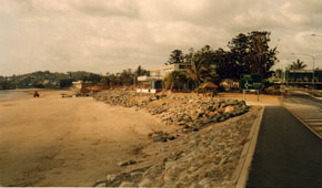
Historical photographs are particularly useful to track environmental change in
coastal areas, especially in places that have been used for recreational purposes,
such as beaches, rivers and creeks. Generations of images survive, most taken
purely for pleasure, from which biophysical baseline data can derived. Most of
us choose to live by the coast, so these photographs also document our ongoing
relationship with Australia’s most heavily populated environment. They allow
us to map the cultural meanings’ we invest in our local natural environment.
|